Thursday, November 22, 2012
Monday, November 19, 2012
Sunday, November 18, 2012
Monday, November 12, 2012
Sunday, November 11, 2012
Friday, October 12, 2012
Monday, September 3, 2012
Thursday, August 2, 2012
Sunday, July 29, 2012
Atlas for The Blind 1837
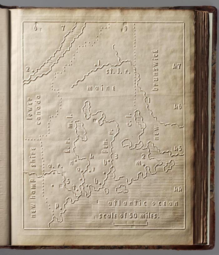
The Atlas of the United States Printed for the Use of the Blind was published in 1837 for children at the New England Institute for the Education of the Blind in Boston. Without a drop of ink in the book, the text and maps in this extraordinary atlas were embossed heavy paper with letters, lines, and symbols. To the best of our knowledge, this is the first atlas produced for the blind to read without the assistance of a sighted person. Braille was invented by 1825, but was not widely used until later. It represented letters well, but could not represent shapes and cartographic features. Samuel Gridley Howe (1801-1876) was the founder and president of the New England Institute (later known as the Perkins Institute) and produced the atlas with the assistance of John C. Cray and Samuel P. Ruggles. Howe was the husband of Julia Ward Howe, the American abolitionist and author of the U.S. Civil War song "The Battle Hymn of the Republic." He was a champion of people with disabilities and believed that blind youth could be taught geography through maps created with his special paper embossing process. In his introduction to the atlas Howe notes that crude attempts had been made to create maps for the blind, but they used primitive methods of creating relief and required the assistance of a sighted person. He claimed that his new embossing method was superior in all respects. Today, it is difficult to know how successful the atlas was, although there can be little doubt that these maps helped Howe's blind students visualize geography. We do know that 50 copies were made and five survive today, including this one. The atlas includes 24 state maps with a page of text describing each state and the symbols used on the maps. In our scans, we have lit the maps and text pages from one side to create shadows that reveal the embossing.
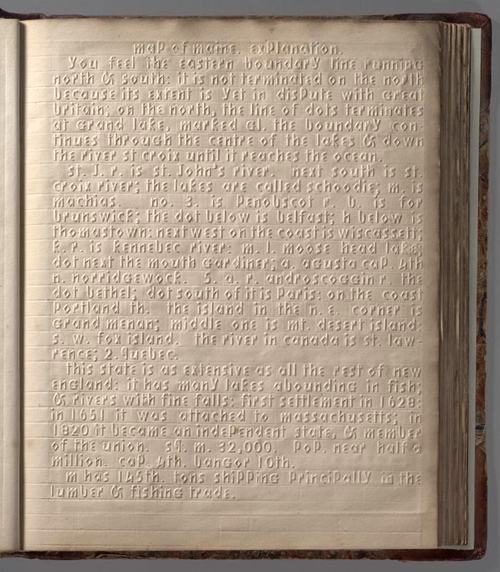
Below is the first map in the atlas, of Maine, with dotted lines showing the border with Canada and New Hampshire. Numbers and letters indicate towns, rivers and lakes, and numbers 6 through 9 and 44 through 47 show longitude from Washington D.C. and latitude. The map shows a scale of 50 miles. All of this and more is explained in the text page for Maine.

The text page titled "map of maine, explanation" that follows the Maine map:
Saturday, July 28, 2012
Tuesday, July 24, 2012
Monday, July 16, 2012
Tuesday, July 3, 2012
Monday, June 11, 2012
Monday, June 4, 2012
Friday, May 11, 2012
Wednesday, May 9, 2012
Tuesday, May 8, 2012
Saturday, May 5, 2012
Wednesday, April 25, 2012
Friday, April 13, 2012
Medieval Book Dug from a Cave in Turkey 2011
The video was recorded in Turkey 2011 by Gobekli Tepe of a relic that was discovered by a local man in a cave. The following pics are screen shots of a video of an ancient biblical book of black vellum pages (animal skin) painted in a gold smelt. Literally, a golden braille (g'rail) book that could be read by the blind. The book is contained in a metal chest that has angels holding (olive branches?)on the top lid, 2 angels facing each other separated by a double helix diamond design. There is also holy spirit/dove on the sides rising, lotus flowers on the bottom portion of the chest. The chest has hinges and hand/flower shaped handles.


The language/writing is currently unknown. I have found a few similarities with Syriac. A distinguished researcher in language and world renown decrypter has offered a suggestion of Norestorian. The book has only been viewed on video and its current location is unknown. Screen shots were captured of all of the pages.
Most pages are script, most likely written from right to left.
If you recognize any of this writing system then please feel free to email me at queen_of_fables@yahoo.ca
There are pictures/drawings on the following pages: Currently incomplete, will be adding more in the near future.
Page 4 Cross
Page 6 Man (3 letters under him, initials or name)
Page 11 Woman (5-6 lettered word/name)
Page 20 Palm Tree
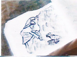
Page 28 God reaching down to a toad/reptile
Page 31 Man riding a donkey departing/arriving from town/temple with man behind him
Page33 Woman teaching child how to use a measurement ruler/compass
Page 35 Balanced scales( peace symbols)
Page 37 Man in India or Tibet, Deep in contemplation
Page 42 Single Cow
Page 44 Two cows
Tuesday, April 3, 2012
Monday, April 2, 2012
Thursday, March 29, 2012
Tuesday, March 27, 2012
Sunday, March 25, 2012
Thursday, January 26, 2012
Friday, January 20, 2012
Walter Russell Theories.. Amazing!!
16 Books:
Walter Russell - Cosmic Illumination as told by Michael Hudak
Subscribe to:
Comments (Atom)


